Why Go Off the Grid in 2026
Beyond the Crowds: Why Desert Solitude Is Booming
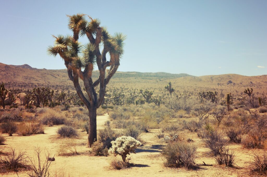
In an era when overcrowded national parks and social media saturated hotspots dominate outdoor recreation, more adventurers are intentionally heading off the grid. Southern California’s desert regions are quietly emerging as havens for those seeking raw nature, solitude, and silence.
What’s fueling the trend?
Overcrowding elsewhere: Yosemite and Zion are amazing but predictably packed.
A craving for real quiet: No traffic noise, no tourist chatter, just wind and dust.
Digital burnout: More hikers are unplugging literally for a few days of mental reset.
Mental Clarity + Physical Challenge
Remote desert treks aren’t just about physical endurance they clear your head, sharpen your focus, and reconnect you with the essentials.
What makes it compelling:
Minimalist terrain = maximum reflection
Tougher routes encourage presence and grit
Sparse landscapes challenge comfort levels in a good way
Many desert trekkers say the mental benefits last far longer than the physical ones. It’s less about clocking miles and more about tuning back into yourself.
Southern California’s Under the Radar Desert Network
While Joshua Tree gets the headlines, the region includes a rich tapestry of less trodden deserts that deliver:
Anza Borrego Desert State Park: Home to canyons, arches, and fossil beds with minimal foot traffic.
Mecca Hills: Ridges, rock walls, and a sense of mystery you can’t get from a paved path.
Mission Creek Wilderness: An unsung link between lowland desert and high alpine trails.
These lesser known spots offer terrain diversity, rich ecological value, and thrilling remoteness all within half a day’s reach from major cities like San Diego and Palm Springs.
If you’re looking to test your limits, disconnect, and explore places few others have seen, 2026 is the perfect year to head into California’s desert backcountry.
Carrizo Canyon Anza Borrego Desert State Park
Carrizo Canyon is what happens when you hike just far enough off grid to make the crowds disappear. Tucked into the southern slice of Anza Borrego, this hike is short in distance but long on character. Think narrow slot canyons, massive desert silence, and if you’re lucky a glimpse of wild bighorn sheep navigating the ridgelines like ghosts.
Timing matters here. The window to safely hike Carrizo is slim: late fall through early spring, when the desert heat simmers down. Any hotter, and it’s a hard no. The trail weaves through dry river beds, over shifting rock, and often disappears without warning. No signs, no comfort, just instinct and real navigation skills. It’s part of the draw.
Don’t expect trail markers or a cell signal. This one’s pure analog. Map it yourself, bring more water than you think, and move with purpose. Reward: silence that stays with you for days.
Essential Planning + Permit Info

Before heading into Southern California’s most secluded desert trails, preparation goes beyond packing. Most of these treks pass through protected areas, which means permit requirements are strict and enforcement is increasing.
Permits Are Non Negotiable
Many of the hidden trails listed fall within:
National Parks
State Parks
Bureau of Land Management (BLM) wilderness areas
To stay compliant, secure the appropriate permits before your trip. Ignoring this step not only risks fines, but also contributes to overcrowding and ecosystem damage in fragile environments.
Need a primer? Explore this guide: Understanding Wilderness Permits in California State and National Parks
Check for Updated Trail Access
Post wildfire restoration, sensitive habitats, and seasonal closures all affect desert trail access often with little notice. Know before you go:
Check with individual park websites or ranger stations
Review BLM updates and alerts
Be aware of trail conditions that may impact permit validity like stream crossings, fallen rock zones, or restricted fire areas
Desert wilderness can close quickly and without cell service, so always check rules and alerts before you lose reception.
Quick Pro Tips
Screenshot permits and access maps in advance
Download offline trail guides (AllTrails, Gaia GPS, etc.)
Call ahead if you’re unsure about regulated zones or permit types
What to Pack for Desert Solitude in 2026
There’s no guessing out here. Prep wrong, and the desert will call you out. First up: bring a satellite communicator. Cell towers don’t touch most of these trails, and radios won’t get you far either. It’s your lifeline if anything goes south.
Next, layer smart. Think light, breathable clothing but not bare skin. The sun doesn’t take breaks, and neither should your UV defense. A hooded sun shirt, a brimmed hat, and lightweight pants go a long way. And don’t forget temps crash late in the day, so pack a thermal layer, too.
Water isn’t optional. Plan for 3 to 4 liters per person, bare minimum, per day. More if the sun’s cooking. And keep it distributed across bottles or a bladder not in one easily ruptured container.
Navigation matters. Download offline maps before you go. Pack a printed topo map and a compass for backup. GPS dies when batteries do, and yes, you should carry a battery pack. Better yet: two.
It’s not just about surviving it’s about respecting what these landscapes demand. Come over prepared or don’t come at all.
Bottom Line
Southern California’s deserts haven’t gone anywhere they’ve just gone quieter. While the rest of the outdoor world is chasing content at crowded viewpoints, there’s still real adventure in the remote corners of the Mojave, Sonoran, and Colorado deserts. The draw? Silence. Solitude. Big sky mornings. And the type of challenge that rewards preparation over popularity.
Timing is everything. Miss the cool season window and you’re dealing with brutal sun and bone dry nothingness. Go too early and you risk flash flooding or impassable washes. Obsessive prep isn’t optional it’s the cost of admission. Check every forecast, carry gear like your life depends on it (because it might), and tell someone your plan before you vanish from signal range.
But if you’re willing to map out every step, carry ten pounds of water, climb a few boulders, and leave only footprints you’ll find the kind of backcountry treks that still feel undiscovered. No crowds. No drone hum. Just rock, heat, dust, and the occasional surprised jackrabbit. It’s worth it.
 Ask Josephine Raybandett how they got into horizon headlines and you'll probably get a longer answer than you expected. The short version: Josephine started doing it, got genuinely hooked, and at some point realized they had accumulated enough hard-won knowledge that it would be a waste not to share it. So they started writing.
What makes Josephine worth reading is that they skips the obvious stuff. Nobody needs another surface-level take on Horizon Headlines, Adventure Gear Essentials, Outdoor Exploration Basics. What readers actually want is the nuance — the part that only becomes clear after you've made a few mistakes and figured out why. That's the territory Josephine operates in. The writing is direct, occasionally blunt, and always built around what's actually true rather than what sounds good in an article. They has little patience for filler, which means they's pieces tend to be denser with real information than the average post on the same subject.
Josephine doesn't write to impress anyone. They writes because they has things to say that they genuinely thinks people should hear. That motivation — basic as it sounds — produces something noticeably different from content written for clicks or word count. Readers pick up on it. The comments on Josephine's work tend to reflect that.
Ask Josephine Raybandett how they got into horizon headlines and you'll probably get a longer answer than you expected. The short version: Josephine started doing it, got genuinely hooked, and at some point realized they had accumulated enough hard-won knowledge that it would be a waste not to share it. So they started writing.
What makes Josephine worth reading is that they skips the obvious stuff. Nobody needs another surface-level take on Horizon Headlines, Adventure Gear Essentials, Outdoor Exploration Basics. What readers actually want is the nuance — the part that only becomes clear after you've made a few mistakes and figured out why. That's the territory Josephine operates in. The writing is direct, occasionally blunt, and always built around what's actually true rather than what sounds good in an article. They has little patience for filler, which means they's pieces tend to be denser with real information than the average post on the same subject.
Josephine doesn't write to impress anyone. They writes because they has things to say that they genuinely thinks people should hear. That motivation — basic as it sounds — produces something noticeably different from content written for clicks or word count. Readers pick up on it. The comments on Josephine's work tend to reflect that.