Wildfire Risk in 2026 What’s New
As hiking season ramps up, so does the danger and 2026 is shaping up to be one of the most unpredictable wildfire years yet. It’s no longer just about being cautious; it’s about fully understanding how current conditions are altering the trails and risks we’ve grown familiar with.
A Season Unlike Any Before
Recent years have taught us that fire season can now start earlier, last longer, and burn hotter. But this year stands out:
Longer burn windows due to extended dry periods
Record temperatures pushing fire thresholds earlier in the year
Increased lightning events, especially in high altitude zones
Climate Shifts Are Fueling the Threat
Climate change impacts are no longer distant warnings they’re shaping backcountry conditions in real time.
Key contributing factors:
Drought followed by growth cycles have caused explosive vegetation surges, especially in foothills and lower elevations
Warmer winters result in less snowpack, drying soil faster and creating prime ignition conditions
Erratic weather patterns mean traditional fire season timelines can no longer be relied upon
Why Popular Trails Are Especially at Risk
Heavily trafficked hiking corridors may feel familiar, but this season they could carry unexpected hazards:
Dry, overgrown access roads increase the risk of vehicle related ignitions
Campgrounds with outdated precautions may not be equipped for this year’s fire load
Crowded routes make emergencies harder to manage, especially with tighter evacuation paths
2026 calls for elevated awareness not just from land managers and firefighters, but from every individual hitting the trail. Staying informed isn’t optional it’s essential.
Before You Hit the Trail
Preparing for your next hike means more than just checking the weather. With wildfire threats increasing each year, hikers need to factor in real time risk assessments before setting out. This is especially true during peak summer months when fire advisories can change daily.
Check Fire Danger Ratings
Before heading to any trailhead:
Visit your local land management agency’s website (e.g., U.S. Forest Service, Bureau of Land Management, or state park portals)
Look for daily or weekly fire danger ratings, usually posted in five levels from Low to Extreme
Don’t ignore “Red Flag Warnings”; these indicate ideal wildfire conditions such as high winds and low humidity
Confirm Trailhead and Campsite Accessibility
Temporary closures are now common as fire seasons intensify:
Check if your intended trail or campground has been closed or restricted
Look for notices about limited access to backcountry areas or high risk zones
Some areas may remain technically open but come with strong advisories against entry
Tip: Most closures are posted by local ranger districts or through park websites with regularly updated alert banners.
Use Real Time Monitoring Tools
Reliable digital resources can help you make informed decisions while planning your hike:
InciWeb (inciweb.nwcg.gov): Official wildfire incident reports across the U.S.
Cal Fire (fire.ca.gov): Excellent for California specific updates
AirNow.gov: Daily air quality forecasts and interactive maps
Windy.com: Tracks active fires, air quality, and wind patterns
AllTrails & Gaia GPS: Integration with wildfire layers or community reported trail conditions
Staying connected to these sources isn’t just smart it’s essential. Wildfire risk doesn’t follow a fixed schedule, and what looked safe in the morning may be off limits by afternoon.
Being proactive before you hike is the first step in responsible trail use during wildfire season. The extra effort could protect not only your safety but also the fragile ecosystems you’re there to enjoy.
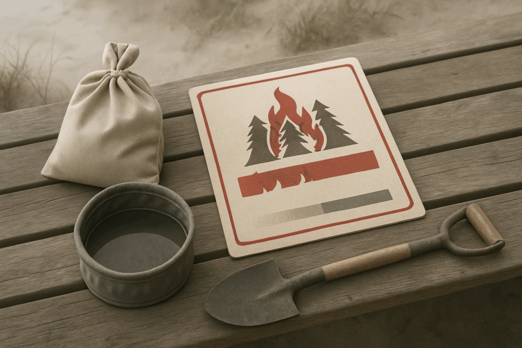
Must Know Fire Safety Practices
Campfires aren’t just discouraged they’re banned across many regions this season, full stop. These bans are legally enforceable and come with steep fines. Doesn’t matter if it’s a chilly night or you think you’ve found a safe patch. If the sign says no fires, that means no exceptions. Fire conditions are too volatile to roll the dice.
Beyond campfires, accidental sparks can start quietly from a loose stove fitting, a dragging tailpipe, even static discharge if the winds are right. So check your gear before you head out. Use only approved camp stoves, and never leave them unattended. Let engines cool before parking on dry grass. That includes cars, trucks, and even your motorcycle.
Staying on marked trails isn’t just about not getting lost; it’s also about not trampling dry brush or delicate vegetation that could ignite under the right conditions. Off trail shortcuts can become spark highways. Trails are designed for lower impact not just on ecosystems, but on fire risk.
Bottom line: fire season isn’t theoretical anymore. The smallest mistake can cost acres. Or homes. Or lives. So hike smart, stay alert, and follow the rules like they actually matter because this year, they do.
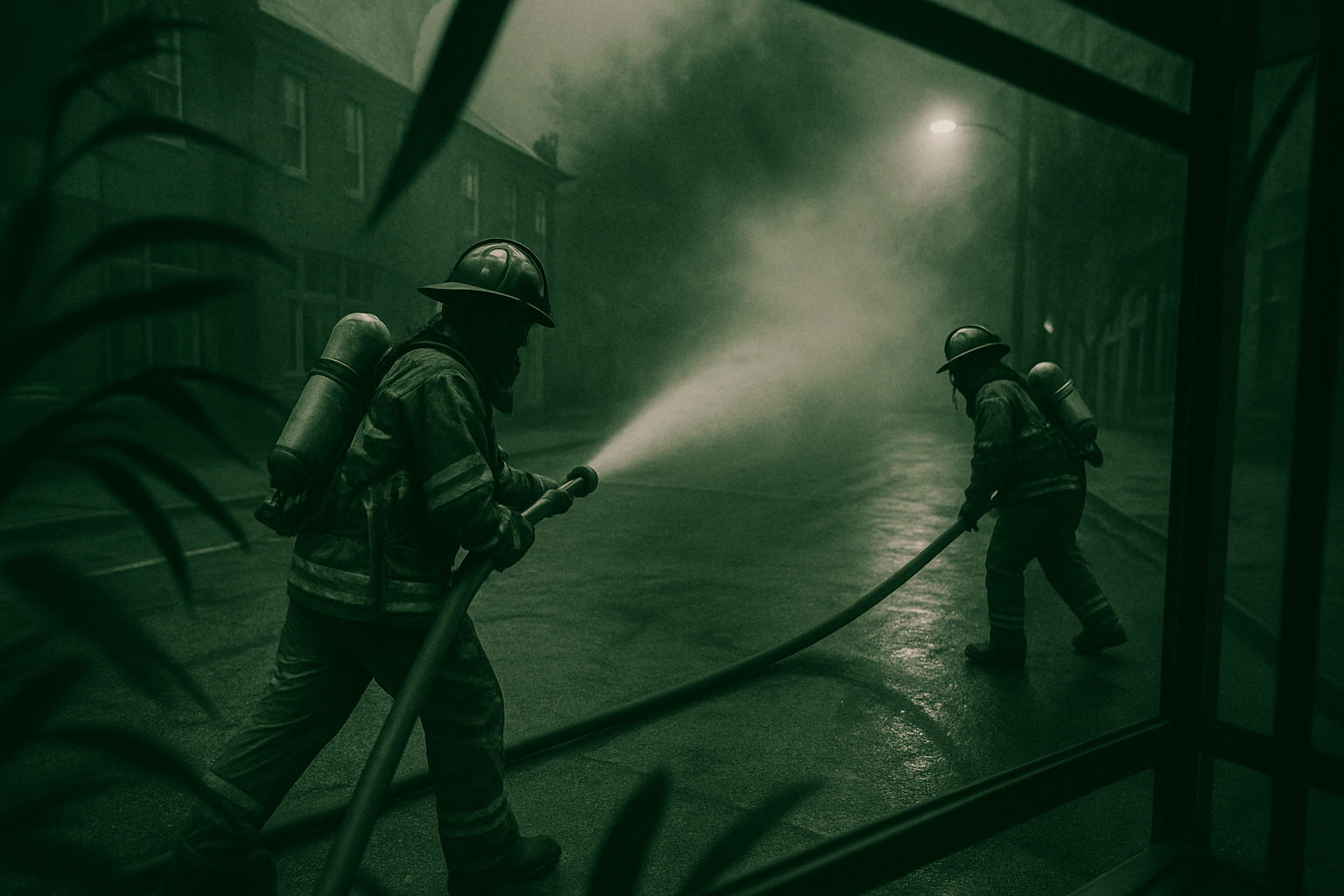
What to Do If There’s a Fire Nearby
Wildfire danger can escalate in minutes. First line of defense: know the signs. Sudden changes in wind direction, unexpected smoke in the distance, or a shift in animal behavior like birds and mammals moving quickly and silently can all hint at a fire encroaching.
If you’re caught near one, speed matters. Drop the gear that’s not essential. Stick to ridgelines or wide trails. Avoid canyons and dry creek beds these funnel both heat and smoke. If you’re off grid and solo, tell someone before your trip and leave your route marked. No one finds what they don’t know is missing.
Comms will likely fail. Cell towers can go down, signal dead zones multiply under smoke. That’s why offline maps, GPS devices with emergency beacons, and pre downloaded evacuation routes are tools you should carry, not just consider. When you can’t call out, your gear speaks for you. Plan for silence.
Being prepared doesn’t make you paranoid. It makes the difference between a tough night and a search party.
Trail Access Rules Are Changing
Trail access isn’t what it used to be. Early closures and rolling restrictions are now common across fire prone regions. Some trails close weeks earlier than expected, and others shut down midday depending on heat, wind, and air quality. It’s a moving target and that’s becoming the new normal.
Local ranger districts are shifting from seasonal schedules to month by month updates, adjusting based on fire risk and available resources. Many publish notices online, but the reality is: you have to double check before every hike. Yesterday’s open trail could be today’s off limits zone.
Because of this instability, trail associations have moved beyond trail maintenance. More are stepping up as trusted messengers, helping educate hikers through updates, signage, social media, and community events. If you’re planning to hit the trails this year, follow these groups closely they often know what’s happening before official sources announce it.
Staying Informed and Involved
In a season where conditions change fast, the best safety tool isn’t gear it’s information. That means checking credible sources regularly: government fire alerts, local ranger stations, verified environmental apps. Don’t rely on yesterday’s update when today’s forecast can shut down a trail in hours.
On the ground knowledge also flows from crews who are unpaid but essential. Volunteer trail stewards, search and rescue support units, and donation funded conservation groups are under pressure this year. Many are stretched thin dealing with closures, reroutes, and cleanups after fire events. If there’s a local group covering your hiking zone, consider pitching in time or money both help.
The future of trekking is being reshaped, one burn scar and detour at a time. We’re moving toward an era where responsible hikers aren’t just outdoor enthusiasts they’re part of a support system. Fewer hands make for harder seasons. The more we stay alert and engaged, the longer we keep trails open and safe.
Top Environmental News Shaping Outdoor Adventures in 2026
 Tavien Quenthos is the kind of writer who genuinely cannot publish something without checking it twice. Maybe three times. They came to cali wilderness expeditions through years of hands-on work rather than theory, which means the things they writes about — Cali Wilderness Expeditions, Horizon Headlines, Hidden Gems, among other areas — are things they has actually tested, questioned, and revised opinions on more than once.
That shows in the work. Tavien's pieces tend to go a level deeper than most. Not in a way that becomes unreadable, but in a way that makes you realize you'd been missing something important. They has a habit of finding the detail that everybody else glosses over and making it the center of the story — which sounds simple, but takes a rare combination of curiosity and patience to pull off consistently. The writing never feels rushed. It feels like someone who sat with the subject long enough to actually understand it.
Outside of specific topics, what Tavien cares about most is whether the reader walks away with something useful. Not impressed. Not entertained. Useful. That's a harder bar to clear than it sounds, and they clears it more often than not — which is why readers tend to remember Tavien's articles long after they've forgotten the headline.
Tavien Quenthos is the kind of writer who genuinely cannot publish something without checking it twice. Maybe three times. They came to cali wilderness expeditions through years of hands-on work rather than theory, which means the things they writes about — Cali Wilderness Expeditions, Horizon Headlines, Hidden Gems, among other areas — are things they has actually tested, questioned, and revised opinions on more than once.
That shows in the work. Tavien's pieces tend to go a level deeper than most. Not in a way that becomes unreadable, but in a way that makes you realize you'd been missing something important. They has a habit of finding the detail that everybody else glosses over and making it the center of the story — which sounds simple, but takes a rare combination of curiosity and patience to pull off consistently. The writing never feels rushed. It feels like someone who sat with the subject long enough to actually understand it.
Outside of specific topics, what Tavien cares about most is whether the reader walks away with something useful. Not impressed. Not entertained. Useful. That's a harder bar to clear than it sounds, and they clears it more often than not — which is why readers tend to remember Tavien's articles long after they've forgotten the headline.